
Package Summary
| Tags | No category tags. |
| Version | 1.12.0 |
| License | BSD |
| Build type | CATKIN |
| Use | RECOMMENDED |
Repository Summary
| Description | autoware src learn and recode. |
| Checkout URI | https://github.com/is-whale/autoware_learn.git |
| VCS Type | git |
| VCS Version | 1.14 |
| Last Updated | 2025-03-14 |
| Dev Status | UNMAINTAINED |
| CI status | No Continuous Integration |
| Released | UNRELEASED |
| Tags | No category tags. |
| Contributing |
Help Wanted (0)
Good First Issues (0) Pull Requests to Review (0) |
Package Description
Additional Links
Maintainers
- ando
Authors
The costmap_generator Package
costmap_generator
This node reads PointCloud and/or DetectedObjectArray and creates an OccupancyGrid and GridMap. VectorMap is optional.
You need to subscribe at least one of PointCloud or DetectedObjectArray to generate costmap.
Input topics
/points_no_ground (sensor_msgs::PointCloud2) : from ray_ground_filter or compare map filter. It contains filtered points with the ground removed.
/prediction/moving_predictor/objects (autoware_msgs::DetectedObjectArray): predicted objects from naive_motion_predict.
/vector_map: from the VectorMap publisher. /tf to obtain the transform between the vector map(map_frame) and the sensor(sensor_frame) .
Output topics
/semantics/costmap (grid_map::GridMap) is the output costmap, with values ranging from 0.0-1.0.
/semantics/costmap_generator/occupancy_grid (nav_msgs::OccupancyGrid) is the output OccupancyGrid, with values ranging from 0-100.
How to launch
It can be launched as follows:
- Using the Runtime Manager by clicking the
costmap_generatorcheckbox under the Semantics section in the Computing tab. - From a sourced terminal executing:
roslaunch costmap_generator costmap_generator.launch.
Parameters available in roslaunch and rosrun
-
use_objectsWhether if usingDetectedObjectArrayor not (default value: true). -
use_pointsWhether if usingPointCloudor not (default value: true). -
use_wayareaWhether if usingWayareafromVectorMapor not (default value: true). -
objects_inputInput topic forautoware_msgs::DetectedObjectArray(default value: /prediction/moving_predictor/objects). -
points_inputInput topic for sensor_msgs::PointCloud2 (default value: points_no_ground). -
lidar_frameLidar sensor coordinate. Cost is calculated based on this coordinate (default value: velodyne). -
map_frameVectorMap’s coordinate. (default value: map). -
grid_min_valueMinimum cost for gridmap (default value: 0.0). -
grid_max_valueMaximum cost for gridmap (default value: 1.0). -
grid_resolutionResolution for gridmap (default value: 0.2). -
grid_length_xSize of gridmap for x direction (default value: 50). -
grid_length_ySize of gridmap for y direction (default value: 30). -
grid_position_xOffset from coordinate in x direction (default value: 20). -
grid_position_yOffset from coordinate in y direction (default value: 0). -
maximum_lidar_height_thresMaximum height threshold for pointcloud data (default value: 0.3). -
minimum_lidar_height_thresMinimum height threshold for pointcloud data (default value: -2.2). -
expand_rectangle_sizeExpand object’s rectangle with this value (default value: 1). -
size_of_expansion_kernelKernel size for blurring effect on object’s costmap (default value: 9).
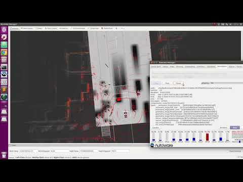
Instruction Videos
costmap_generator_lanelet2
This node behave exactly like costmap_generator node, but uses different map format for wayarea.
Input topics
/points_no_ground (sensor_msgs::PointCloud2) : from ray_ground_filter or compare map filter. It contains filtered points with the ground removed.
/prediction/moving_predictor/objects (autoware_msgs::DetectedObjectArray): predicted objects from naive_motion_predict.
/lanelet_map_bin: from the lanelet2_map_loader. /tf to obtain the transform between the vector map(map_frame) and the sensor(sensor_frame) .
Output topics
same as costmap_generator
How to launch
run:
roslaunch costmap_generator costmap_generator_lanelet2.launch
Changelog for package costmap_generator
1.11.0 (2019-03-21)
- [Feature] costmap generator
(#1774)
-
- Initial commit for visualization package
- Removal of all visualization messages from perception nodes
- Visualization dependency removal
- Launch file modification
-
- Fixes to visualization
- Error on Clustering CPU
- Reduce verbosity on markers
- Publish acceleration and velocity from ukf tracker
- Remove hardcoded path
- Updated README
- updated prototype
- Prototype update for header and usage
- Removed unknown label from being reported
- Updated publishing orientation to match develop
-
- Published all the trackers
- Added valid field for visualization and future compatibility with ADAS ROI filtering
- Add simple functions
-
- Reversed back UKF node to develop
- Formatted speed
- Refactor codes
- Make tracking visualization work
- Relay class info in tracker node
- Remove dependency to jskbbox and rosmarker in ukf tracker
- apply rosclang to ukf tracker
- Refactor codes
- Revert "apply rosclang to ukf tracker"
- Revert "Remove dependency to jskbbox and rosmarker in ukf tracker"
- Revert "Relay class info in tracker node"
- delete dependency to jsk and remove pointcloud_frame
- get direction nis
- set velocity_reliable true in tracker node
- Add divided function
- add function
- Sanity checks
- Relay all the data from input DetectedObject
- Divided function work both for immukf and sukf
- Add comment
- Refactor codes
- Pass immukf test
- make direction assisted tracking work
- Visualization fixes
- Refactor codes
- Tracker Merging step added
- Added launch file support for merging phase
- lane assisted with sukf
-
- change only static objects
- keep label of the oldest tracker
- Static Object discrimination
- Non rotating bouding box
- no disappear if detector works
- Modify removeRedundant a bit
- initial commit for costmap generator
- add vague stucture
- add brief structure fot points2costmap
- refactor codes
- add sensor points costmap
- add waypoint costmap
- bug fix for wayarea2costmap
- add simple structure for objects2costmap
- add vague structure for waypoints2costmap
- Replacement of JSK visualization for RViz Native Markers
- add occupancy grid visualization
- add objects costmap
- add minimum height threshold for pointcloud
- debug computing.yaml from objects_topic to objects_input
- Add blurred costmap
- Add comment on computing.yml
- visualizing bug fix
- Make sure object's cost is 100 and blurred outside of objects
- add costmap_generator package
- add unit tests
- delete test launch file
- Apply autoware ros clang
- Add README
- sync develop's readme
- sync develop's code
- add convex hull costmap
- Relay ros header appropriately
- change interaface for generating costmap from points
- add test for points2costmap
- Modify for how to pick up convex-hull points
- add test
- add test for objects2costmap
- Added missing include
- Added missing grid_map_ros dependency
- Updated include
- Re-strutured include folders
- Generic folder name
- Fix/costmap generator (#2077)
- segmentation fault in CheckAssignPoints2GridCell
- Remove redundant codes in test
- Add some variables in SetUp
- rename class
- rename files
- modify tests
- Add scription in SetUp
- Remove unnecesary in_object
- Refactor test codes
-
- Contributors: Kosuke Murakami
Wiki Tutorials
Package Dependencies
| Deps | Name |
|---|---|
| autoware_build_flags | |
| catkin | |
| autoware_msgs | |
| grid_map_ros | |
| object_map | |
| pcl_ros | |
| roscpp | |
| tf | |
| vector_map | |
| lanelet2_extension |
System Dependencies
Dependant Packages
Launch files
- launch/costmap_generator_option.launch
-
- lidar_frame [default: velodyne]
- map_frame [default: map]
- grid_min_value [default: 0.0]
- grid_max_value [default: 1.0]
- grid_resolution [default: 0.2]
- grid_length_x [default: 50]
- grid_length_y [default: 30]
- grid_position_x [default: 20]
- grid_position_y [default: 0]
- maximum_lidar_height_thres [default: 0.3]
- minimum_lidar_height_thres [default: -2.2]
- expand_polygon_size [default: 1.0]
- size_of_expansion_kernel [default: 9]
- use_objects_box [default: false]
- use_objects_convex_hull [default: true]
- use_points [default: true]
- use_wayarea [default: true]
- objects_input [default: /prediction/motion_predictor/objects]
- points_input [default: /points_no_ground]
- use_ll2 [default: false]
- launch/costmap_generator.launch
-
- lidar_frame [default: velodyne]
- map_frame [default: map]
- grid_min_value [default: 0.0]
- grid_max_value [default: 1.0]
- grid_resolution [default: 0.2]
- grid_length_x [default: 50]
- grid_length_y [default: 30]
- grid_position_x [default: 20]
- grid_position_y [default: 0]
- maximum_lidar_height_thres [default: 0.3]
- minimum_lidar_height_thres [default: -2.2]
- expand_polygon_size [default: 1.0]
- size_of_expansion_kernel [default: 9]
- use_objects_box [default: false]
- use_objects_convex_hull [default: true]
- use_points [default: true]
- use_wayarea [default: true]
- objects_input [default: /prediction/motion_predictor/objects]
- points_input [default: /points_no_ground]
- launch/costmap_generator_lanelet2.launch
-
- lidar_frame [default: velodyne]
- map_frame [default: map]
- grid_min_value [default: 0.0]
- grid_max_value [default: 1.0]
- grid_resolution [default: 0.2]
- grid_length_x [default: 50]
- grid_length_y [default: 30]
- grid_position_x [default: 20]
- grid_position_y [default: 0]
- maximum_lidar_height_thres [default: 0.3]
- minimum_lidar_height_thres [default: -2.2]
- expand_polygon_size [default: 1.0]
- size_of_expansion_kernel [default: 9]
- use_objects_box [default: false]
- use_objects_convex_hull [default: true]
- use_points [default: true]
- use_wayarea [default: true]
- objects_input [default: /prediction/motion_predictor/objects]
- points_input [default: /points_no_ground]